7 Best Hikes Closest to Seattle during FIFA World Cup
Visiting Seattle for work, fun, or the FIFA World Cup? These hikes are great after work or for a quick trip on the weekend. Enjoy your time in Seattle by checking out these hikes. I’ve done all these hikes during my time in Seattle and they are what I recommend for a quick weekend/weekday hike for people visiting Seattle. In other words, they are for people who do not hike regularly and who want a high reward-to-effort (and drive time) ratio. Keep reading for my list of the 7 Best Hikes Closest to Seattle during FIFA World Cup.
Seattle is known for having gray skies and constant rain. So obviously if it is raining outside or it is a dreary day, some of these hikes aren’t going to be that spectacular! So keep that in mind when planning what to do.
- Is Wizz Air a Real Airline?
- The Ultimate Guide to Washington Hiking Passes: Which One Do You Actually Need?
- 7 Best Hikes Closest to Seattle during FIFA World Cup
- 45 Creative Travel Journaling Prompts
- How to Keep a Travel Journal
7 Best Hikes Closest to Seattle during FIFA World Cup
Here is the quick stats summary for all 7 hikes before we jump into the details:
| Hike | Highway | Distance | Elevation Gain | Required Pass | Main Feature |
|---|---|---|---|---|---|
| West Tiger 3 | I-90 | 5.5 miles | 2,100 feet | Discover Pass | Steep forest climb / conditioning |
| Dirty Harry’s Balcony | I-90 | 4.4 miles | 1,600 feet | Discover Pass | Rocky balconies overlooking valley |
| Rattlesnake Ledge | I-90 | 4.5 miles | 1,300 feet | None | Sheer ledges overlooking lake |
| Wallace Falls | Highway 2 | 5.6 miles | 1,300 feet | Discover Pass | Multi-tiered rushing waterfalls |
| Mount Si | I-90 | 8.0 miles | 3,625 feet | Discover Pass | Challenging peak & mountain views |
| Bridal Veil Falls | Highway 2 | 4.0 miles | 1,000 feet | NW Forest Pass | Thundering waterfall spray deck |
| Twin Falls | I-90 | 3.6 miles | 500 feet | None | Rushing river & suspension bridge |
7 Best Hikes Closest to Seattle during FIFA World Cup
1. West Tiger 3
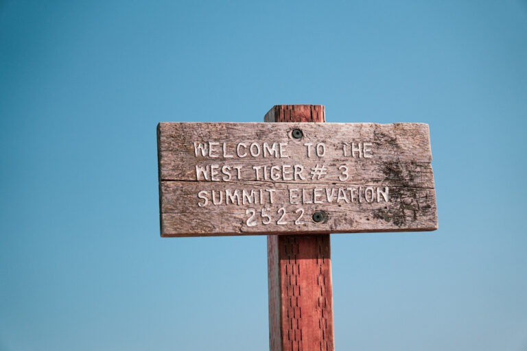
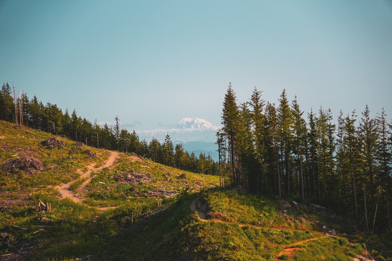
West Tiger 3 is the ultimate after-work conditioning hike. It is located just 30 minutes outside of Seattle in Issaquah, making it one of the easiest trails to reach if you are short on time.
The trail climbs steadily through a dense, green forest. While it does not offer a massive glacier view at the top, it is incredibly clean, well-shaded, and perfect for getting a quick workout. It is one of my favorite places to trail run or power-hike on a weekday afternoon when I need to clear my head.
This is a bit steep and intense, but the lookout at the top is wonderful!
- Highway: I-90 (Exit 20)
- Main Feature: Steep forest climb & local conditioning
- Distance: 5.5 miles round-trip
- Elevation Gain: 2,100 feet
- Required Pass: Discover Pass
- Drive Time: 30 minutes
2. Dirty Harry’s Balcony
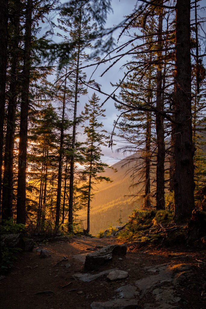
If you want solid views of the Snoqualmie Valley without the massive crowds of Mount Si, Dirty Harry’s Balcony is a fantastic alternative.
The trail winds up through a rocky, mossy forest along the I-90 corridor. The payoff is a series of rocky ledges (the “balconies”) that offer great spots to sit, eat lunch, and watch the cars look like tiny toys below. The trail can be a bit rocky and rooty, so wear shoes with decent traction.
- Highway: I-90 (Exit 38)
- Main Feature: Rocky balcony overlooks of Snoqualmie Valley
- Distance: 4.4 miles round-trip (note: my Garmin watch often logs closer to 6.6 miles total depending on parking and side trails)
- Elevation Gain: 1,600 feet
- Required Pass: Discover Pass
- Drive Time: 50 minutes
- Read my full Dirty Harry’s Balcony Trip Report for more detailed trailhead logistics.
3. Rattlesnake Ledge
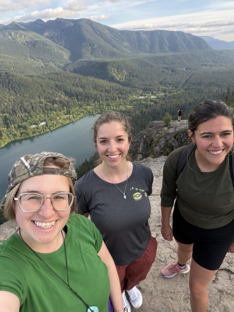
Rattlesnake Ledge is easily the most popular day hike near Seattle, and it is easy to see why. The trail is wide, clean, and has a very gentle, consistent grade all the way to the top.
Once you reach the summit, you are treated to sheer, dramatic rock ledges overlooking the bright blue water of Rattlesnake Lake below. It is absolutely stunning. The only catch is that it gets incredibly crowded on weekends. If you want to enjoy the view in peace, plan to start before 8:00 AM or head up for a sunset hike.
- Highway: I-90 (Exit 32)
- Main Feature: Sheer rock ledges with panoramic lake views
- Distance: 4.5 miles round-trip
- Elevation Gain: 1,300 feet
- Required Pass: None
- Drive Time: 45 minutes
4. Wallace Falls
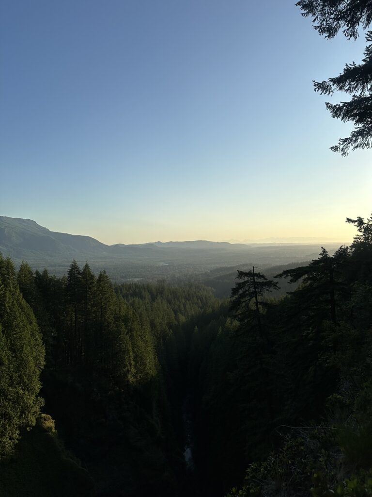
Wallace Falls is hike that is good on rainy days and sunny days… however, as you can see above, it is quite spectacular on clear days! Itis a river walk under a heavy forest canopy, the trees block most of the rain, and the wet weather actually makes the waterfalls look even more powerful.
(I am retroactively making this post, so I don’t have any pictures of the falls themselves… just the views!)
The trail follows the Wallace River and takes you past three main waterfall viewpoints: Lower, Middle, and Upper Falls. The Middle Falls viewpoint offers the best photo opportunity, with a panoramic view of the water dropping 265 feet.
- Highway: Highway 2 (Gold Bar)
- Main Feature: Multi-tiered rushing waterfalls along a river gorge
- Distance: 5.6 miles round-trip
- Elevation Gain: 1,300 feet
- Required Pass: Discover Pass
- Drive Time: 45 minutes
5. Mount Si
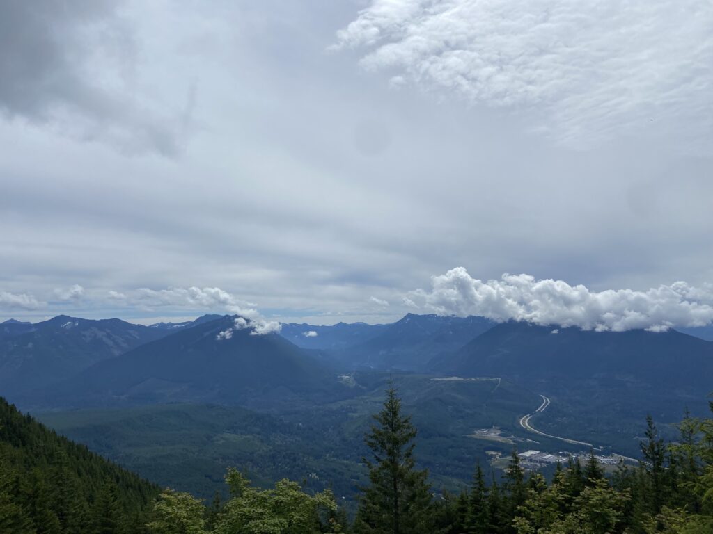
Mount Si (often called “Big Si” by locals… myself included) is a classic Seattle hiking rite of passage. If you want to test your legs and see how you match up against local hikers, this is the mountain to climb. I did this hike for the first over 4 years ago and I still remember my legs burnnnnning on this hike. Lots of hardcore people use this to train for other big hikes given the steep elevation gains.
It is a steep, relentless climb up through the forest. Once you reach the top, the views of Mount Rainier and the Snoqualmie Valley are spectacular. (or at least they are on a day you can see them!) For the adventurous, there is an optional rock scramble at the very top called the Haystack, but most hikers are content to sit at the base of the rocks and enjoy their snacks.
- Highway: I-90 (Exit 32)
- Main Feature: Challenging mountain climb & expansive valley views
- Distance: 8.0 miles round-trip
- Elevation Gain: 3,625 feet
- Required Pass: Discover Pass
- Drive Time: 40 minutes
6. Bridal Veil Falls
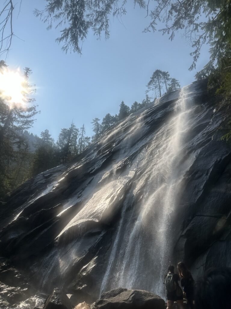
Bridal Veil Falls sits along Highway 2 near Gold Bar, climbing up the side of Mount Index. The trail takes you directly to a wooden viewing platform right next to the thundering falls.
You will get sprayed with mist as you stand at the viewpoint, which is incredibly refreshing on a warm day. The final stretch to the falls features a series of steep wooden steps, so get ready to feel the burn in your calves. If you have extra energy, you can continue past the waterfall trail junction to reach Lake Serene, which is 8 miles total.
I’ve done this hike in November as well, so it works great for a shoulder season hike as well as peak summer!
Don’t forget to visit the Espresso Chalet on the way there (or on the way back!) to get some delicious alpine coffee. the bigfoot sign will greet you 🙂
- Highway: Highway 2 (Gold Bar)
- Main Feature: Close-up spray deck of a thundering mountain waterfall
- Distance: 4.0 miles round-trip
- Elevation Gain: 1,000 feet
- Required Pass: NW Forest Pass (or America the Beautiful Pass)
- Drive Time: 1 hour
7. Twin Falls
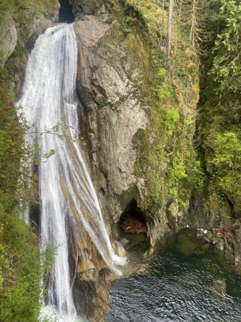
Twin Falls is a very chill, family-friendly hike along the South Fork Snoqualmie River. It has minimal elevation gain and is a great option if you want a relaxing walk rather than a steep mountain climb.
The trail takes you through a beautiful, moss-draped forest to a suspension bridge that hangs directly between two gorgeous waterfalls. It is a fantastic spot to take photos and enjoy the sound of the rushing water.
This was actually the very first hike I ever did in Seattle… Wow! My mind was boggled that I could go on a beautiful hike just a short drive away… compared to the hours and hours of driving I used to do to get from Florida to North Carolina. Definitely recommend this one as a good intro to Washington Hikes.
- Highway: I-90 (Exit 34)
- Main Feature: Rushing river gorge & suspension bridge between waterfalls
- Distance: 3.6 miles round-trip
- Elevation Gain: 500 feet
- Required Pass: None
- Drive Time: 45 minutes